GPS Modeling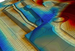
Global positioning models are fairly new to the grading industry and Vertis Consulting is proud to have been one of the first companies to use this ground-breaking technology. Once your CAD file is complete, it is imported into our modeling software, and then our engineers create an accurate model of your project. This model is then inserted into either a GPS-controlled machine or a roving grade checker, which collects data. All models are compatible with AGTEK, Trimble, and Topcon receivers. Because we customize each model, we can include as little or much detail as you wish so you can focus on the aspects that matter most without excess data getting in the way. Because we have highly skilled engineers on staff, we can turn your model around in as little as five days, allowing you to avoid delays and keep your project moving.
|